

It is even more interesting that the mathematical statistics on the growth of mankind confirm that the whole of mankind originated from one small group of people several thousand years before Christ. Similar conclusions were reached by Italian and Japanese geneticists. However, such facts are not welcomed by the public, because they defy the established dogma of Darwin’s theory of evolution. The grandfather of researcher Robin Simmons worked as a doctor in Eastern Turkey and Russia between 1904 and 1910, at the very foot of Great Ararat – the place where, according to local tradition, the ark of Noah and his family landed after the Great Flood.
Some of the Kurds and Armenians there whom he treated told him exactly that – that Noah’s ark was preserved on that mountain, high up on the north side, just below the pass of the extinct double-peaked volcano, and showed him that spot on an old photograph Ararata also found out that the old names of the places in that area largely contain memories of the Ark – Noah’s Village, the First Vineyard, the House of Sam – Sam was one of Noah’s sons, the ancestor of the Semites, the City of the First Market, the Place of the First Descent… Most of these names today they are no longer used, but they are very specific in the Old Armenian language.

There are, however, other legends about the place of Noah’s landing. The Koran, for example, also talks about the Ark – but it says that it landed on Al Qudiya, a mountain about 300 kilometers south of Ararat, while the Iranians claim that Ararat is on their land – Mount Kuh e Alwand.
There is a famous story about the months-long expedition of the soldiers of the Russian Emperor Nicholas II, who allegedly entered the Ark and photographed it, mapped the position, somewhere in the rugged, canyon-crisscrossed upper regions of the Armenian side. This expedition was undertaken just before the October Revolution, during which, it is thought, the majority
during the campaign itself, they were killed, and photographs, maps and artifacts disappeared. Relatives of several survivors confirmed the authenticity of that expedition.
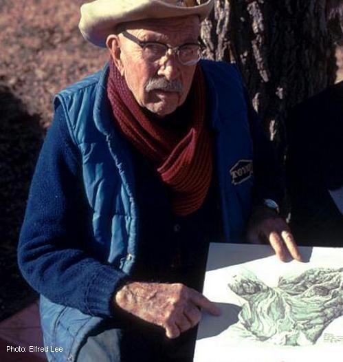
The Engineer’s Story
American Ed Davis, was in 1943 an army engineer of the US army, who built supply roads in Turkey and Russia. Doing some favor to their driver’s village, which is near Ararat, the driver’s relatives offered to take him to the place where the Ark can be seen, which prayed under the ice in retreat. On the way, they stopped in a village where there was a cave with supposed artifacts
found in the ice, which appeared in the Ark after the melting of the ice. There were oil lamps, clay barrels and antique tools. After traveling for several days, on horseback and on foot, they reached a cave that was decorated with some beautiful old writing, which is thought to be located at a height of about 2500 meters on the western wall of the Ahora Gorge. Indeed, explorer Ed Crawford later discovered a cave in Ahora Gorge with apparently pro-Assyrian petroglyphs that can be interpreted as an immediate post-Flood religious text. The next day, a guide showed Davis a horseshoe-shaped crack in the ice and said: There’s Noah’s Ark. At first Davis couldn’t see anything, but soon he caught sight of him. It was in his words: A huge, rectangular, man-made structure partially covered in ice and rock, lying on its side. At least 30 meters was clearly visible. I could even see the inside, a part of it had been broken through – through that hole, some tree trunks were sticking out, and water was coming up from under the structure. Inside the collapsed section, which he was told was the largest, Davis saw at least three stories. The guide told him that near the top there is a residential area of 48 rooms. He also told him that inside there were cages as small as a fist, but also large enough for a family of elephants. They planned to rappel down the next day, but the weather turned so bad overnight that they had to turn back.
Satellite images
George Stephan is a military-trained specialist with 30 years of experience interpreting all types of satellite imagery who says he has access to every square foot of planet Earth. He says: I was looking at the mountain, from a height of 3050 meters above the summit, using the PAMS system (special photo analysis of material spectrum). I am one hundred percent convinced that there are two man-made structures, one below the other, on the 3,962-meter elevation on the northern side of the mountain. Both look as if they were once joined, as there is a spectral trail between them…
When he marked the locations of the anomalies he found on a topographic map of Ararat, they turned out to be the same ones that Robin Simmons had been marked by his grandfather. However, things do not add up to Davies’ story – he did not mention crossing the ice plains.
Aerial shots
A few months later, Simmons and Adams flew over Ararat in a plane, but the Turkish authorities did not allow them to land. By taking videos of it, and especially of Ahora Gorge, they soon identified the wanted point, a frozen wave-like formation hovering over something embedded in the glacier. Circling above the mountain, Simmons was trying to find a trace of the second, broken-off part of the object that George Stephan determined was about 335 meters below, in a steeper part of the glacier. And indeed, there he managed to photograph a similar structure with a broken end and a roof covered, barely visible in the ice wall. Still circling above the terrifying Ahora Gorge, Simmons surveyed a spot that matched Ed Davis’ description from a height of about 750 meters. And indeed, another similarly anomalous object protruded from the steep ground, with what looked like a pointed roof and vertical walls, the end of which appeared to be broken. If it was also the Ark, then, according to Davis, there would have to be another similar part beneath it, trapped even deeper in the ice. All three objects were remarkably similar, and all could in fact have been parts of the Ark, which the Bible says was about 150 meters long – or even two feet longer if the cubit measure is in fact a royal cubit.
What exactly is hidden there
But the story gets even weirder. According to one source, who spoke to Simmons only on condition of complete anonymity, in 1974 an American special operations team was engaged in recording a Russian radar system that tracked flights from Turkey to what was then
USSR. Returning via Ararat, in order to escape detection, the team was caught in a storm and found shelter in a crevasse. When they entered it, they thought it was an old Byzantine sanctuary – but they realized that the altitude was too high for such a thing, so they unanimously concluded that it was – the biblical Ark. Their report, code-named Black Spear, also reached the US president, because Simmons was told by a friend of the president’s adviser that the adviser had seen the still-secret Oval Office report, which included specific mention of what the operatives in question believed. that a part of the real Noah’s Ark is preserved, trapped in the ice.
Another similar story, full of details, was disclosed. Between December 1959 and April 1960, one pilot made about fifty flights from a secret Turkish base into the Soviet Union, in order to distract the Soviets from simultaneous American flights. Returning to Turkey through the Russian-Iranian border zone, next to Ararat, on the left side, he says, he often saw and photographed an oblong, rectangular coffin-like object, which protruded from the ice at about 4,500 meters.
height. Now, according to him, those recordings are stored seven floors below the Pentagon.
-The question arises, why is all this being covered up?
-Who cares if the Flood and the Ark remain only legends?
Could the findings from the Ark deal a decisive blow to the already shaky Darwinian theory and who knows what other valid scientific theories? And maybe they would also fundamentally shake the ruling political systems in the world.
-Is that perhaps why Greater Ararat is inaccessible for research today? Because the Ahora gorge is a prohibited zone for any climbing and photography. The approaches are mined, and the place is secured by military fortifications.

Leave a comment